 |
||||||||||||||||||
|
 |
|||||||||||||||||











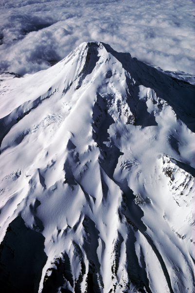
Mount Hood Fly-By
Location: Probably about 18,000 feet. On approach to Sea-Tac in Seattle.
Find the location: Copy the coordinates below. Open Google Earth, paste the coordinates into "Fly To" and click on the magnifying glass.
45° 22' 25.84" N
122° 41' 46.28" W
Equipment: DC-9, Canon A-1, 28-85mm lens, Ektachrome 64, polarizing filter, two drinks, Valium 5 mg.
Digital imaging/manipulation: Digital imaging/manipulation: Image scanned with Minolta Dimage Scan Multi PRO at 4800 dpi. Emulsion artifact removed.
Notes: This was taken in the early 80s. As we approached Seattle, I was shooting some pictures of Mt. St. Helens from the right side of the plane. I think that's starboard. Anyway, the flight attendent said, "If you want to take pictures of the mountains, you should come over here." I expected to see Mt. Hood in the distance. I wanted to take a picture of it, I didn't want to land on it. If you are going to shoot pictures this way, remember to roll down the window.
If you experience any problems on this website, please contact the webmaster. Website designed by Dru Furbee.