 |
||||||||||||||||||
|
||||||||||||||||||


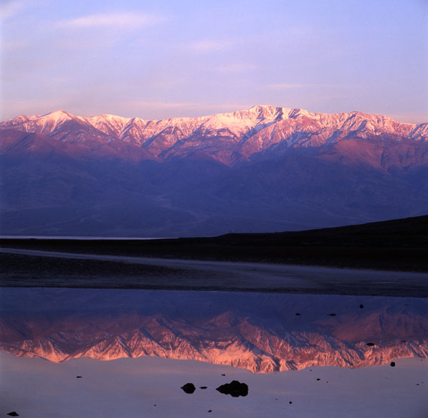
Death Valley - Bad Water
Location:Death Valley National Park, California. About 2 1/2 hours west of Las Vegas, but can be accessed from several areas in California.
Find the location: Copy the coordinates below. Open Google Earth, paste the coordinates into "Fly To" and click on the magnifying glass.
36° 13' 49.61" N
116° 46' 00.71" W
Equipment: Hasselblad C501 with 50 mm lens and polarizing filter. Velvia transparency film, ISO 50.
Digital imaging/manipulation: Image scanned with Minolta Dimage Scan Multi PRO at 4800 dpi. Emulsion artifact removed.
Notes: Bad Water is the lowest point in the US (at least on land). It is 282 feet (85.5 m) below sea level. The Panamint Range is in the background. Easy access, short walk, wouldn't drink the water. This is a very enjoyable (and large) national park. Furnace Creek Inn and Ranch are nice places to stay.
If you experience any problems on this website, please contact the webmaster. Website designed by Dru Furbee.