 |
||||||||||||||||||
|
||||||||||||||||||


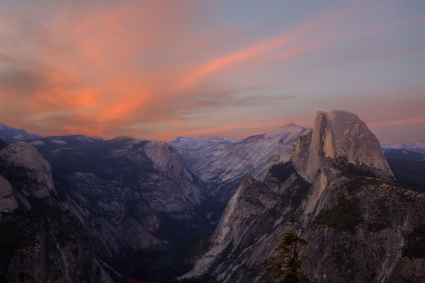
Glacier Point Sunset
Location: Half Dome from Glacier Point. Yosemite National Park. Shot in June of 2012.
Find the location: Copy the coordinates below. Open Google Earth, paste the coordinates into "Fly To" and click on the magnifying glass.
37° 43’ 46.01” N
119° 34' 21.60” W
Equipment: Canon EOS 5D Mark II, 24-105 lens (at 35 mm) for 10 sec. ISO 50 with polarizing filter.
Digital imaging/manipulation: Just a bit. Three exposures were tonemapped in Photomatrix 4.0 HDR. Two pictures were made from those three exposures, one with the best foreground lighting, one with the best sky. Those were combined to get the best overall exposure. Lens flares were removed from Tenaya Canyon. Come to think of it, it might have been easier just to fly back out there and take the picture again.
Notes: Great place for pictures of the valley. Sunset is the more colorful time of day. Time of year also affects how directly the sun stikes the face of Half Dome. You can climb Half Dome if you like, but then you have to hang over the top to get a picture of it and I wouldn't recommend that. It's said to be one of the most dangerous trails in the park, but we laugh at danger... usually from a long distance. To get there, you leave Yosemite Valley and go south to Glacier Point Road. This is the way to Badger Pass Ski Area, Sentinal Dome, and eventually, Glacier Point. There is a large parking area at the end of the road.
If you experience any problems on this website, please contact the webmaster. Website designed by Dru Furbee.