 |
||||||||||||||||||
|
||||||||||||||||||


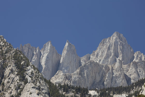
Location: From Reno Airport go south on US 395 to Lone Pine, CA. That's about 260 miles (4 1/2 hours). Whitney Portal Road heads west from a stop light at the south end of town. This road leads to the base of the mountain and the trailhead to the top.
Find the location: Copy the coordinates below. Open Google Earth, paste the coordinates into "Fly To" and click on the magnifying glass.
36° 35' 22.24" N
118° 13' 47.34" W
Equipment: Canon EOS 1Ds MarkIII, 100-400 lens, polarizing filter. Shot at f11, 1/20 second, ISO set at 50.
Digital imaging/manipulation: None
Notes: This is shot toward the end of Whitney portal road. There is a gift shop and a place to buy food. This is the trailhead for the trail to the peak. No we didn't climb it. The best view of the mountain is seldom from the top, grasshopper. At least that's my excuse.
If you experience any problems on this website, please contact the webmaster. Website designed by Dru Furbee.