 |
||||||||||||||||||
|
||||||||||||||||||


Location: From Reno Airport go south on US 395 to Lone Pine, CA. That's about 260 miles (4 1/2 hours). Whitney Portal Road heads west from a stop light at the south end of town. Along the way to the parking area at the base of the mountain, is the turn-off into the Alabama Hills. The parking area for the Alabama Hills Arch is located as indicated below. The trip from Whitney Portal Road is a few miles and is graded gravel. The hike to the arch is perhaps a half mile.
Find the location: Copy the coordinates below. Open Google Earth, paste the coordinates into "Fly To" and click on the magnifying glass.
36° 36' 40.75" N
118° 07' 29.85" W
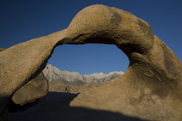
Equipment: Canon EOS 1Ds MarkIII, 24-105 lens, polarizing filter. Shot at f22, 1/5 seconds , ISO set at 50.
Digital imaging/manipulation: OK, if you look at the shadow under the arch, a portion of it extends toward the mountain. The right edge of that shadow was razor sharp and the angle where it meets the base of the shadow was so acute that it looked unatural so I decided to make it natural. By sofening the edge and angle, your eye doesn't go directly to it. Well mine doesn't. Then again I have a lazy eye. I could have saved myself some trouble and left it alone considering that now that I've told you it's all you can look at, isn't it?
Notes: The Alabama Hills are a great foreground for the mountain. Mount Whitney is the white pointy thing that's left of center through the arch. It doesn't jump out at you because closer peaks and even the foothills appear taller. This is a morning shot.
If you experience any problems on this website, please contact the webmaster. Website designed by Dru Furbee.